

Flight Instruction

Raptor Drones’ Chief Pilot has 30+ years of experience as an instructor of various subjects including drone flight operations, Search & Rescue, and law enforcement.
If you are a new drone owner and would like personalized instruction, contact us.
Mapping
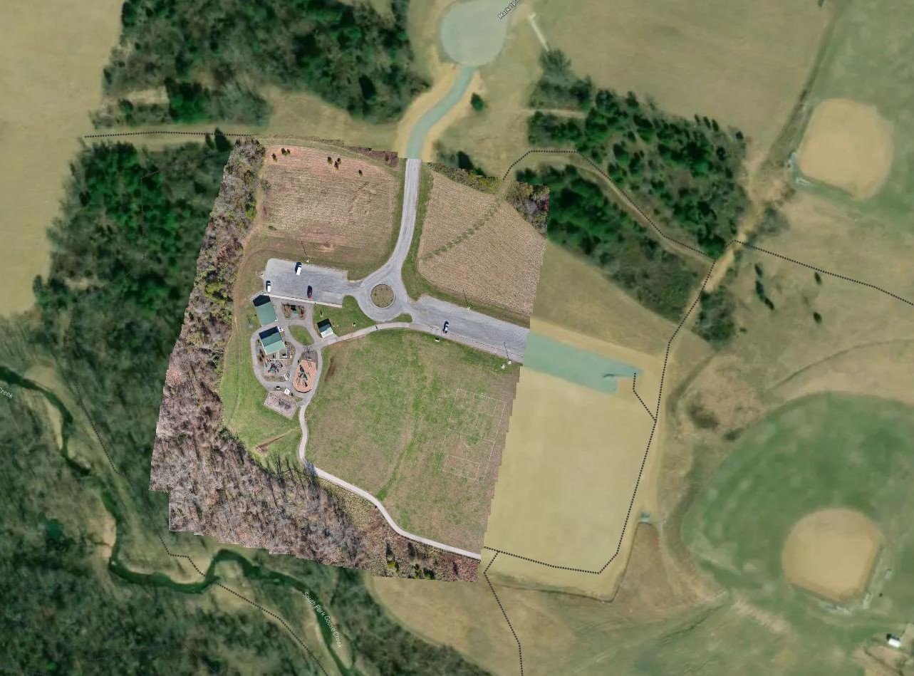
Maps created for clients are comprised of multiple photographs taken from a fixed altitude. These photos are stitched together to create a highly accurate map. Areas and distances can be measured and delineated in customizable reports.
OUR SERVICES
Raptor Drone Services offers a wide variety of services:
Individual or Group Flight Instruction (drones supplied)
Facility and property mapping
Construction Progression
Facility Inspections (bridges, roofs, dams)
Structure and utility assessment
Facility Inspection

Photos and videos captured by drones can highlight the best aspects of your home, property, or business. Whether for marketing, locating roof damage or utility assessment, Raptor Drone Services can provide the data. Services available for residential and commercial clients.
Construction Progression

Whether it is a modest residential venture or a major commercial endeavor, Construction Progression capture by drone can showcase project milestones and document the work done on site.